

16 November – 01 December, 2017
It now feels that an adventure is unfolding. Planning nights away from home, work and family requires another level of organisation, extended weather forecasting, limited landing opportunities with vehicle access, check point and contingency planning. There is much more of a shared involvement and dependency now, as each leg is a voyage into new territory for both of us.
THIS TRIP: Kiritehere to North Muriwai (Rimmers Rd) 5 paddle days
Overall Distance 212.0km Time 29.93hrs Speed 7.1km/hr

16 November, 2017 Kiritehere – Manu Bay, Raglan

Shaz and I arrive at Marokopa Camp last night and got ready for an early start. I rise at my usual 4:30am and head to the kitchen to prepare and consume a solid protein packed breakfast and shake for my longest paddle to date.
Launched at the stream and out through an easy surf at Kiritehere at high tide (0630hrs). Check-in with Shaz beyond the surf zone and confirmed our next check point from Ocean Beach, Kawhia; hopefully as I get line of sight rounding Albatross Point. Surprisingly could easily contact Coastguard by handheld VHF to log a TR just off Marokopa. Cruised along the coast until I sighted the Taharoa buoy a little further out wide and decided to visit. The calm conditions continue as I head for the majestic Albatross Point and a good reason to dwell for 10 minutes over some lunch and watch/listen to the surf smashing into its cliffs; imagining what it could be in typical West coast conditions.


From here the coastline recedes towards Kawhia as I cut straight across the bight towards Ruapuke Beach. After a VHF check-in with Shaz on Ocean Beach, Kawhia, she heads to Ruapuke Beach for our next check-in. There is a very slight following wind now as I depart Albatross but not enough to be any assist with the sail, which I bring along as a contingency safeguard for this, the longest open water trip so far. I am very conscious of managing hydration and nutrition and although still experimental, the need for simplicity is key. I make a point of stopping to snack and drink every hour and I have plenty of both to keep me going. (Protein bars, bananas, crackers, ham, cheese, boiled eggs, bier sticks, peanut slabs) The energy levels are great for the first 8 hours, when although I recognise the first signs of fatigue, there is still plenty in reserve.
Soon into the bight crossing I see some dolphins in the distance and soon after something whacked into my stern. Looking around I get a glimpse of a dark shape and a splash but don’t really know what it is.

After checkin-in again with Shaz as I near Ruapuke I see a large gannet workup. Decided to sprint about 3km to get amongst them which was a buzz. Tried to see what they were diving for but underwater gopro footage didn’t show up anything.

The SW breeze increased as I closed in on the coast towards Raglan and for a while I hoisted the sail but this proved too unstable for me in a light yak, so down it came. The sail “experiment” suggests that it would only add value within a very narrow wind range on a lightish kayak in a typical west coast seaway. Am of the opinion now, after further practice trials at home, that it may only be considered for the longer paddle days as a possible safety contingency if an emergency retreat is required for a distant shore.
17 November, 2017 Manu Bay, Raglan – Port Waikato

Launch at Manu Bay timed to arrive at Port Waikato at low tide for easier landing. Calm launch and crossing of Raglan bar with light off shore (SE) wind.


Forecast of SW 10-13kt turned into SW 20-25kts and unpleasant. Constant looking back in following sea and swell. Found myself “quartering” Secala frequently in the following conditions to keep stable in the light kayak. Made for a fast trip.
Despite the rough conditions requiring my constant attention, I felt strong throughout the day. Only drank 1.5lt due to being constantly focused and busy in the conditions. (Need to look into a hands free hydration arrangement)
Still finding that I’m underestimating geographical distances. Glad to turn the point at Port Waikato and find the beach in front of the surf club largely protected from the SW sea/swell. Easy landing but no Shaz to greet me as she had just shot off to have a coffee!


Highlights: Following wind & sea; felt strong after the big day yesterday; easy landing Port Waikato. Some paddle fitness at last, maybe! Lowlights: Had to use spare paddle (#1 paddle lost off roof rack, eh Shaz!); dodgy weather forecast
18 November, 2017 Port Waikato – Hamiltons Gap


Easy launch through the rocks in low surf despite Shaz yelling at me that I hadn’t put my rudder down properly.
An offshore SE breeze was forecast so planned to head out a couple of kms to give the Waikato river mouth a wide berth before turning back to hug the coast for protection from SE. Local fisherman advised at least 1km off river mouth was advisable.
Had a following sea and good speed all the way north and while keeping close to the shore, needed to be very watchful of shoals and sand banks that could surprise me. Great to have Shaz confirm her location on the beach at Hamiltons Gap with her mirror.


Good timing on entry at Hamilton gap on the back of a wave and a nice ride through surf and sprint to beach. Another well timed dry landing. Enjoying it while it lasts.
Coastline was a mix of rolling farming pasture and imposing cliffs as we approach Manukau heads.
Drank only 1 lt. Felt strong, no aches, pains or stiffness on any of the three days. Building some required paddle fitness and cautious confidence for the daunting harbour crossings to come.
Secala proving to track very well in windy and uncomfortable conditions on the quarter.


29 November, 2017 Hamiltons Gap – South Piha

After a night spent at Waiuku, a leisurely start to the day to get around the renowned Manukau Bar. This is the first major harbour that I am negotiating with quite a reputation so the are nerves are jangling, however the forecast could hardly be better.
An easy enough launch at high tide straight off the little creek at Hamiltons Gap in predicted low swell height of 0.8m .


Set out wide in calm conditions looking for the infamous bar. Aimed for a good 5km wide of the entrance and in the calm conditions could easily see and keep clear of the lines of breakers (at half ebb) straight off North Head. (Thank you Lynn Paterson for your sage advice). Adjusted course to clear them a good half km seaward but watchful of some isolated lumpy areas of swell. Seemed to take a long time to cross the entrance. Once round the bar headed towards the distant coast. Couldn’t recognize any landmarks so just as well Shaz was on the beach with VHF and mirror flashing at the agreed time to guide me in. Another well timed easy landing though the surfers at South Piha. Never been to Piha and it was cool to come in an unconventional way. This distance covered today would normally be a very easy days paddle but felt pretty tired after this one. Could be due to a bit of a cold I’m trying to shake. Another easier day tomorrow which was the plan after several days off the water and leading into the big Kaipara Harbour crossing day.


Highlights: Easy launch at Hamiltons, knocking off Manukau Bar, Piha landing


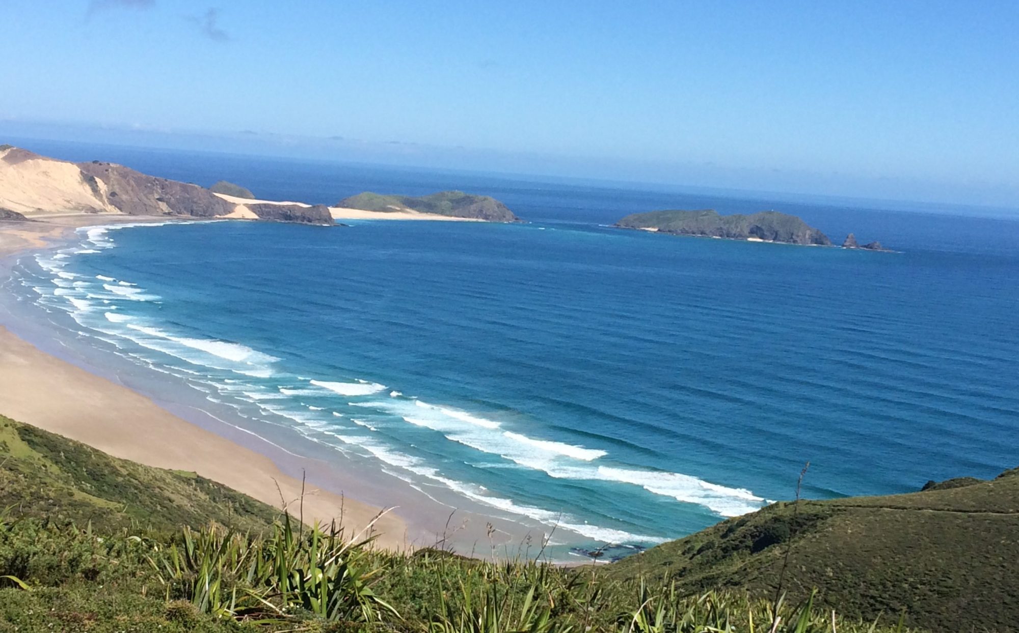
30 November, 2017 South Piha – North Muriwai (Rimmers Rd)

Surf was up at Piha this morning. High tide and a few sets of rollers to get though. A tad nervous as didn’t want to start the day with a turtle. Got out in one piece under Shaz’s scrutiny. Dramatic wild untouched coast between Piha and Muriwai. Had a radio check with Shaz at Muriwai lookout before continuing north to Rimmers Rd, the only vehicle access to the North Muriwai beach . Surprisingly in this area TR’s to the coastguard were unsuccessful all day. Another day of calm conditions with a whisper of SW later on.


Getting real nervous going up this coast as big sets rolled through and thundered onto the notorious Muriwai beach. Eventually reached Rimmers and just as well Shaz was on the beach in pink and with her mirror. Would never have picked the landing spot otherwise, although my GPS proved accurate. Expecting carnage on landing with several sets of rollers to negotiate at low tide. Watched several sets before committing and sprinting on the back of a set. Timed it perfectly to an easier than expected landing in the end. Had to drag Secala up the soft beach on wheels and a couple of hundred meters up and over the dunes to the ute in the car park. Hard work!


01 December, 2017 Rimmers Road launch attempts (to transit Kaipara)
Swell had significantly increased to 1.8m+ as predicted for this morning, and it was high tide. Clearly had several sets to get through with some decent breakers further out. It was clear that a lot of timing and luck would be required to get through that lot. Breakers got bigger further out. A fully laden yak (for likely overnighter) made it hard to get momentum between breaking waves. Often got pushed backwards in the tumbling surf. After four attempts, once very nearly making it out, I accepted that the West Coast was the boss today; and not for the last time no doubt.
Positives
Good practice discovering surf limits in loaded Secala. Secala was more stable but harder (slower) to get momentum between breakers
Good experience realising my limits in these surf conditions. Attempted rolls failed in the tumbling surf. Never felt troubled or at risk at any time.
Learned best to stay clear of Secala in surf especially the rudder area!
Observation – Need to practice rolling in surf conditions. On three of the four attempts I don’t think rolling out was an option due to the strength and duration of the turbulence.

NOTE TO SELF:
Ideal surf conditions for Rimmers:
Swell < 1.3m
Low tide but any tide should be ok in low swell
Launching at mid flood tide should give favourable current around Kaipara bar and ebb flow on north side of harbour
SW or SE winds to assist paddle north
For earliest start, suggest camping the night at the beach with yak and gear ready to go.
Good web site you’ve got here.. It’s hard to find high quality writing like yours nowadays. I truly appreciate people like you! Take care!!