

12 – 15 February, 2018
This weeks forecasts looked good with paddleable days most of the week. The main objective was to get around the mighty Kaipara Harbour that was jangling my nerves a little as this would be the longest and most challenging paddle yet, in terms of, not only distance, but tidal currents, distance off shore, unknown territory, the notorious breaking bars and not many favourable B options if things didn’t go to plan.
Also, for the first time, Shaz was not going to be with me for most of the week as she returned to work after dropping me off through Rimmers Road access to North Muriwai Beach. This meant that I would be fully self sufficient for the first time. This provided the additional new challenges of significantly increased kayak weight, correct weight distribution and changed handling in the surf, that I had to get to grips with quickly.
Feeling more vulnerable without Shaz watching out for me, I fitted the sail, even though I had dismissed this experiment some time ago. It provided a remote but possible “means of escape” if west coast forecast conditions didn’t eventuate. They did, with a calm rounding of the bar and light afternoon headwinds before calm conditions returned in the evening.
THIS TRIP
North Muriwai (Rimmers Rd) to Glinks Gully 2 paddle days
Overall Distance 95.0km Time 15.38hrs Speed 6.18km/hr

Monday, 12 February, 2018 North Muriwai Rimmers Rd – Rangitira Beach

Travelled north back to Dargaville yesterday. On arrival we checked out the surf at Rimmers Road, the place of the mauling I received back in December. The surf was low as forecast; and it was low tide. I was stoked. If it remained like that for tomorrow, it would be an easy launch. I did not want another failed attempt off this beach.
My two big objectives this trip were to get out of the Rimmers surf and to transit the Kaipara Bar which will be the longest and most challenging paddle I have done so far.
The initial plan today was to have Shaz drop me off at the beach at Rimmers and to camp overnight on the beach so I could have an early start at first light in the morning. Otherwise access to the beach wouldn’t be available till the forestry access gates are opened at 0600, which would mean about an 0700 launch after dragging Secala over soft sand from the road end car park to the surf. A 4WD vehicle would have been handy here. Since I need every hour of available daylight for this paddle and camping “officially” not allowed on the beach; I decide on plan B to paddle up Muriwai beach for 4 hours and camp “unofficially” on the dunes. This would reduce the big Kaipara transit paddle by an equivalent time tomorrow.
With a short day scheduled, I dragged the fully laden kayak over the dunes at a casual 1030hrs. By far the heaviest Secala has been so far. Along with all the overnight camping gear required I had to accomodate enough water for 2 days paddle and an overnight camp.
The surf was higher than yesterdays observation but still an easier launch compared to the previous carnage here. Launched at about 1100, just after the HW. Once through the break I kept on paddling fast for a good 400m just to be sure. Memories of the outer surf breaks lingering. Stopped and checked in with Shaz on the beach, as usual. I think we were both mighty happy to be out of Rimmers at last and making progress north again.


The paddle was straight forward into a 8-10kt Nly headwind at first before the breeze veered offshore (Ely).
Arrived at about 1500 near enough to my intended destination (Rangitira Beach) although it wasn’t easy to tell exactly on a uniform beach with no land marks. After approx 4 hours paddling I figured I was close and started looking over the surf for a likely place to camp. The dunes were undercut by the tide making them high and steep with the scrub right up to the edge. I needed to find a spot where trees had been undercut and fallen over onto the beach providing a means to access the top of the dune to safely set up camp. Found a likely spot and negotiated a smooth landing. Arriving early allowed some time to charge the battery pack with my solar panel, establish a camp and get ready for a dawn start tomorrow. After climbing the higher nearby sand dunes, I eventually found some tenuous Spark cellphone coverage and ordered flowers for Shaz for Valentines Day. Brownie points for sure (-:
Highlights: Getting out of Rimmers; Setting up camp and first opportunity to test all new gear; Reducing the distance for the big day tomorrow (which proved to be a good and necessary move); Great camp and sunset


Tuesday, 13 February, 2018 Rangitira Beach, North Muriwai
After a stormy night I wake up to mist, showers and poor visibility. Although the surf and sea conditions were really good, there was no way I was going to attempt a transit of the Kaipara without good visibility. Spent the morning trying to collect rain water and reading. By the time conditions lifted sufficiently it was midday and there wasn’t enough daylight hours left for me to consider a launch today. Went for a walk north along the beach hoping to reach the harbour entrance. Evidently its a little further than 5km away. A couple of friendly local 4WD’s trekked up and down the beach at low tide.


Wednesday, 14 February, 2018 North Muriwai (Rangitira Beach) – Glinks Gully

What a day!!
Woke at 0420, eaten and decamped by 0520. Secala packed and waiting for first light to launch. Had preped lunch and sorted what I could the day before for a quick getaway. As soon as I could see the surf it was evident that the surf was well up and over the forecast 1.6m swell and at 0620 it was 2 hours past low tide. Despite the swell being higher than I wanted it to be, it was doable with timing and luck. I needed to give it my best shot or the alternative was to somehow return back to Rimmers which was the nearest exit to civilisation 25km back down the beach. I was on my minimum supply of water for any kind of large paddle day. Another day landlocked by the surf would mean a Kaipara transit would be out of the question this trip.
My first two launch attempts were failures in the tumbling surf!! My rolling attempts failed in the dumping surf suggesting my best chance of getting out was to get my timing right and have a little more luck; and quickly, as it was energy sapping stuff. I am learning quickly that the fully laden Secala is a different proposition in the surf.
The Second Attempt


On the third attempt I did time my sprint perfectly and got out the back of the surf. The time lost recovering from my two failed attempts (about an hour) contributed to some smoothing of the surf breaks on the rising tide. It still required a good degree of timing and luck and I was over the moon when the larger outer breakers didn’t eventuate for me this time and I had an anxious but clear run. I didn’t stop paddling for a good couple of hundred meters just in case.
And then I kept paddling for another 200m just in case …………
Disbelief that I have finally broken free from the constraints of the beach was quickly displaced by great relief and joy. I could now focus on moving forward again, at last.
Contacted Coastguard with my TR and continued to have good comms with Coastguard throughout this trip.

I set a compass course of 270 (West) that according to the chart would get me round the back of the bar. After an hour or so paddling I checked the GPS that showed that I was being sucked into the harbour significantly by the flooding tide.
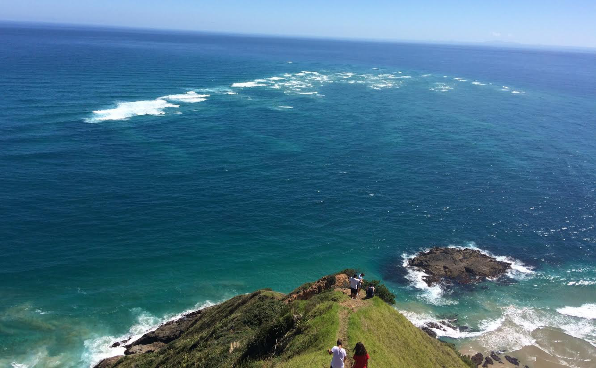
I made a radical 45 degree course adjustment to 225 (SW) to paddle directly away from the coast in the hope of limiting the tidal influence. Although it was a fine and calm day, I now had the coast directly behind me and my only point of reference was my compass. I kept a keen eye way ahead and to my right while I paddled for another two hours until I could see and negotiate around the last of the huge breakers. These breakers reared up suddenly from a small lump on the smooth ocean to a house sized surge of tumbling waves. These were quite spectacular the closer I got. The heart rate leapt a notch or two as I inadvertently got as close as a couple of hundred meters from one set of breakers. I eventually adjusted my course back to the West but I needed to be absolutely sure that I had cleared the outermost breakers before being confident to swing North and make my way back towards land. Really discovered the extent of this huge harbour and bar that stretched out for at least 6km. Very glad with my decision to remain on the beach yesterday as good visibility is essential to safely negotiate around this bar. A calm sea provided earlier means of detection of the outer bar. A constant and keen eye ahead was necessary to ensure I didn’t cut across the entrance too early and risk getting caught out by one of these huge rollers. Weather and sea conditions were perfect for the rounding of the bar, starting with a whisper of an offshore NE subsiding to flat calm conditions. I saw several sharks out wide but none of them paid any attention to me.
Once cautiously rounding the bar by a good margin, I aimed for the very distant shore passing over a few work-ups along the way. Not sure if they were tuna or kahawai. This leg back into the North Kaipara shore was scheduled to take 6 hours and the tide was due to ebb. As I got closer to shore in the afternoon a light NW headwind set in and the sea got fairly lumpy as the tidal stream exiting the harbour opposed the wind waves. Thankfully the ebbing tide was in my favour as progress seemed very slow in the head wind. Convenient landmarks were not on offer. Updated my TR with Coastguard twice extending my ETA at Glinks. Reassuring to have good CG contact all day. With about 2 hours to paddle my water and food supply ran out. Wasn’t worried as I had made a point of hydrating and nourishing at regular intervals all day. Still felt strong but frustratingly Glinks seemed to take forever to arrive. Thankful now to have put in the training hours off the Taranaki coast. Kept the tempo up as the sun declined. I was determined to grind it out until finally Glinks came into view about an hour and a half before sunset.


As I pulled into the surf a 4WD full of locals driving along the beach stopped and glared for a few minutes in bemusement that a kayak had just landed on their beach. No offers of help though! After dragging the heavy Secala up the beach, I set out to replenishing my water supply from the campground up the hill and see if there was cellphone reception up there so I could let Shaz know that I had arrived. By the time I had stashed Secala high up in the dunes and lugged my camping gear to a patch of grass behind the dunes, the day was coming to an end. Still no Spark reception to contact Shaz.


A local bach owner (Tony) introduced himself and offered some tea and a shower which was much appreciated. Took him up on the hot shower which was great but didn’t want to impose on his kindness to include the dinner offer. Satisfied my appetite with dehydrated venison risotto. He also charged my Goal Zero power pack and GoPro. Resigned to the fact that I wouldn’t be able to contact Shaz tonight; I finally got to bed pretty tired at about 2230.
Thursday, 15 February, 2018 Glinks Gully launch attempt
Woke up at 0415 as usual, feeling tired and thirsty but instantly went straight back to sleep and didn’t wake till 0730 when a truck drove past the tent. Still feeling tired and stiff I climbed up the dune to check the surf. It looked doable and the forecast was good so had to give it a go. I hadn’t pre organised myself for todays paddle as I usually do for a quicker getaway so wasn’t ready to launch until about 0900. Later than desirable with the prospect of a 7hr paddle to Arangi beach or 11hr to Waimamaku beach depending on progress!
Launched at the same spot that I had landed as it still looked the easiest spot with fewer sand bar breaks to get through. Patiently negotiated between sets of breakers sitting in the holes between them before timing the next advance. Got out to the last (biggest) break, saw a gap between sets and made the final dash. Just as I was to break free the bugger reared up and smacked me fully in the chest. Still having a fully laden kayak meant that Secala tended to plow through the cresting waves rather than over them. I rolled a couple of times in the turbulence before unfortunately having to bail. Had to get back to the beach from a fair way out. Unbeknownst to me Tony and his family and friends had been watching from the dunes and all rushed down to see if I was all right. Tony said if I had got another few meters ahead I would have cleared it. I knew this. The heavily laden kayak is not so quick off the mark. Tony suggested he get his 4×4 and trailer to take me up the beach a few hundred meters to a better spot to launch, in his opinion. I took him up on the offer and was thankful for his enthusiasm to share his local knowledge and help out.

Tony’s spot didn’t look any better to me with the bigger surf breaks out wide still looking menacing. Same deal, negotiate each set in the hollows, again and again, being patient ……… and then I got really clobbered hard at the final hurdle again, my upper body being driven hard back onto the deck. After what seemed a very long time tumbling in the surf, I bailed. When I surfaced I realised that the rudder had completely sheared away from the hull. There was now two holes in the hull to the rear compartment. This would effectively put the kibosh on any further progress north until repairs could be made.
Tony (and the others) were waiting on the beach till I got washed up again. Seeing my plight and realising my trip is curtailed for now, Tony drove me and my kayak up to the campground and offered to call Shaz (Vodafone) to tell her my situation. Vodafone reception was very patchy but possible in some locations at beach level. Local knowledge is key here. One of the campers said Spark reception was possible up the hill behind the camp, and if not, he would drive me up the road a few k’s to a high spot he knew. Anyway up the hill I got hold of Shaz to her relief.
Spent the day sorting out gear and getting to know some of the campers. Learned that tuatuas are thick on the beach at the moment and that they were going to get their quota of 150 at low tide. I said I would join them and tried to find out a bit more about the lifecycle of the tuatua. Was told by the locals that they had not been at this beach for about 25yrs until 2 years ago when they arrived in big numbers then nothing last year and now back again in big numbers. Had fun getting my quota of tuatuas which only took about 20mins.
Really unfortunate I couldn’t get out today as paddling conditions were ideal. Fine day and light winds would have assisted progress but not at all unhappy about how it has turned out. Harvesting and eating tuatuas for the first time was a real highlight. The campsite has great views and only $10pn &$1 for shower.


Friday, 16 February, 2018 Glinks Gully layover
Now it’s a wait until Shaz can return north to pick me up, probably tomorrow. Just a matter of enjoying Glinks now. Quickly got to know other motorhome owners at the camp …….. Kate, Derrick, Lynn, Steve, Flay and Mike. Kate and Derrick showed me how to gather tuatuas and Flay patiently showed me how to shuk them. Was a real treat having Kate cook up and share some of her renowned tuatua fritters and raw marinated tuatuas.


Local identity and sculptor, Archie McCahon, who made himself known when I arrived, offered to take me on a 4WD road trip 50km down the beach to Pouto at the Kaipara harbour entrance. Low tide was mid afternoon so he picked me up at 1300. Besides the novelty of screaming down the beach with no other traffic, and no cops, I got a great history lesson of the area from Archie going way back to settler times with the kauri timber exports out the harbour, the 150 or so ship wrecks at or around the harbour entrance, the geology and flora, fauna of the area. Fascinating, as this was unexplored territory for me. Archie stopped at the two exposed wrecks that we came across. Wrecks are exposed and covered with the constantly shifting sands.


Wow!!! You have opened yet another “window”. Thanks. I have been asked to COMPILE a book in the True Tales of ……. series of Glinks Gully. Last year I did Te Kopuru. I have thoroughly enjoyed reading your blog and wonder if you will please write a story about your arrival at Glinks Gully, your “stay” there – and why – it would be a great story and your photos are excellent too. Your comments about trying to get phone access – well everything really, and the various characters who you met is all of interest. Then your eventual escape from Glinks Gully. It would be sensible to mention Secala Kayak Adventures as these books are found far and wide these days. Looking forward to hearing from you. Christine
Hi Christine
Glad you enjoyed this. This Kaipara paddle and Glinks arrival (and exit) certainly stands out as one of my most satisfying achievements on the West Coast. Will touch base soon.